UK drone survey & aerial mapping
Drone surveys you can build on.
Topographic, LiDAR, photogrammetry and volumetric surveys to OS grid, flown by CAA-authorised crews and delivered as CAD-ready data for councils, contractors and survey firms across the UK.
- Lat
- 53.24751 °N
- Lon
- 1.61162 °W
- Alt
- 120.0 m AGL
- GSD
- 1.5 cm/px
- GNSS
- 32 sats
- Solution
- RTK FIX
01Why Skykam
Everydesigndecisionstartswiththeground.Wecaptureitfromtheair,controlittoOSgrid,proveitagainstindependentcheckpoints—andhandyourengineers,estimatorsandplannersdatatheycansignoffagainst.
- Typical vertical RMSE
- ±20 mmTypical vertical RMSEphotogrammetry with GCPs, hard surfaces
- Surveyed from the air
- 48,000 haSurveyed from the airacross the UK
- Projects delivered
- 350+Projects deliveredfor public & private clients
- Typical capture to CAD, working days
- 5 daysTypical capture to CAD, working dayssites up to 20 ha
Trusted by teams across the public and private sector
Selected clients











- CAA Operational Authorisation · valid to 28 June 2027
- GVC-qualified remote pilots
- £10m public liability insurance (Coverdrone)
- OSGB36 · ODN · OSTN15 / OSGM15
- Constructionline Gold
- SSIP · Once For All Health & Safety
- Project data processed in the UK
- RAMS & procurement pack on request
02Services
Four drone survey products. One standard.
- 01Topographic SurveysFeature-coded 2D and 3D topographic surveys from aerial data, tied to OS National Grid and ODN and verified against independent checkpoints.Vertical accuracy±20–30 mm
- 02LiDAR SurveysClassified LiDAR point clouds and bare-earth terrain models for wooded, vegetated and linear sites, captured by drone and checked against ground truth.Vertical accuracy±30–50 mm
- 03Photogrammetry & MappingGeoreferenced orthomosaics, digital surface models and textured 3D models at 1–2 cm resolution, controlled and accuracy-reported.Ground sample distance1.0–2.2 cm
- 04Volumetric & Stockpile SurveysStockpile, excavation and void volumes measured by drone, typically within ±1–2%, with tonnages and reconciliation-ready reporting.Volume accuracy±1–2%
03How it works
From flight line to finished drawing.
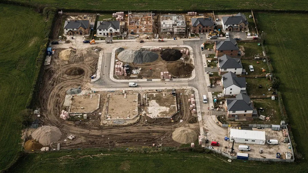
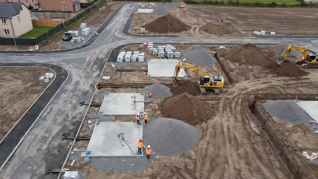
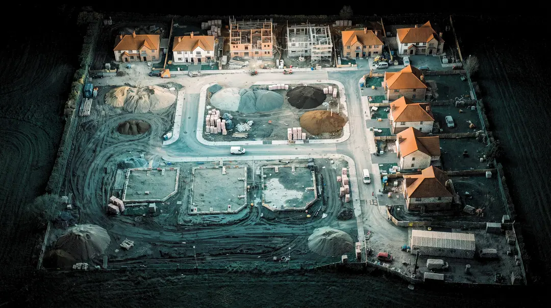
One accountable team from brief to CAD. Scroll to follow an example 12-hectare housing site through our workflow.

01 · Plan
Plan the mission
We agree extent, accuracy and deliverables, check airspace and permissions, then design flight lines, overlap and ground control for the site — before anyone leaves the office.
02 · Fly
Capture, controlled
A CAA-authorised crew surveys the control network with GNSS, then flies automated RTK missions at a fixed height above ground — every image geotagged to centimetres.
03 · Process
Process to a model
Photogrammetry and LiDAR pipelines produce a dense, classified point cloud, adjusted to OSGB36 and ODN. Independent checkpoints prove the accuracy before anything is drawn.
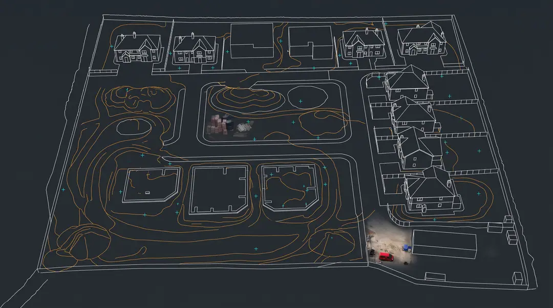
04 · Deliver
Deliver CAD-ready data
Feature-coded topographic drawings, surfaces, contours, orthomosaics and volumes in your formats and layer standards — issued with a survey report you can put in front of a client.

04Deliverables
One flight. Every layer your project needs.


- What it is
- Millions of measured points, classified and coloured by elevation. The raw evidence behind every other deliverable.
- Best for
- Detailed 3D design, volumes and change detection, and answering new questions later without re-flying.
- Formats
- LAS · LAZ · E57
Illustrative visualisation of a sample site
05Sectors
Built for the people who commission surveys.


06Scope estimator
Not sure what to ask for? Start here.
Recommended approach
Topographic survey
Photogrammetry controlled to OS grid is the fastest route to survey-grade levels on open ground.
- Time on site
- 0.5 days
- Resolution
- 1.3 cm/px GSD
- Typical accuracy
- ±20–30 mm vertical
- Turnaround
- 5 working days
Indicative only. Your fixed quote confirms method, accuracy and programme.
Get an exact quote07Case studies
Evidence, not adjectives.


Client reviews
What clients say.
5.0 on Google reviews
“By far the best Drone Surveying Company that I have used. Responsive, helpful and the quality of their reports is on the money. They are also knowledgeable of what they are surveying and are extremely diligent in highlighting building defects outside of the scope. I have undertaken 10+ projects with them to date and if you are looking for a problem free contractor that produces what is requested then you won't be disappointed in selecting SkyKam.”
“I have used Skykam on numerous occasions for aerial shots on sites I have been inspecting for my work. I have always been impressed with how professional and skilled they are. Their attention to detail is second to none and I have always found Skykam to be very committed to delivering exactly what the customer wants.”
“Fantastic company to do business with. I have now been working with James at Skykam since early 2021 and it has been an absolute pleasure working with one another.”
“We had James and he was very helpful. He provided a very professional and accommodating service. Clear communication and the results were as expected.”
08UK coverage
One team. Every postcode.
09Insights
Know what to specify.


10FAQ
Questions buyers ask us.
It depends mainly on site area, required accuracy, vegetation, deliverables and access. As an indication, a small survey-grade topographic survey typically starts from around £1,200 excluding VAT, and larger LiDAR surveys run into several thousand pounds. We provide a fixed quote once we have your boundary and requirements.
A site boundary (KML, DWG, shapefile or marked-up PDF), what the survey is for, the deliverables and accuracy you need, the coordinate system and your programme. If you are not sure of the specification, tell us what you need to design or decide and we will recommend one.
On open, hard or short-grass ground we typically achieve 15–30 mm vertical RMSE, verified against independent checkpoints. Accuracy is lower on long grass and under vegetation, and we state the expected accuracy by surface type in our quote.
We measure independent checkpoints on the ground with survey-grade GNSS or total station and withhold them from processing. Every survey is delivered with a control and accuracy report showing each checkpoint residual, the mean error and the RMSE.
Yes. Skykam holds a CAA Operator ID and an Operational Authorisation in the Specific category, and our remote pilots hold a Flyer ID plus a GVC or equivalent qualification. We will send copies of our authorisation and pilot credentials on request.
We hold £10m public liability insurance with Coverdrone and £10m professional indemnity insurance. Certificates are provided with our pre-contract documents, and we can name principal contractors or clients as interested parties where required.
Typical formats include DWG and DXF for CAD, LandXML and GeoTIFF for terrain models, GeoTIFF and ECW for orthomosaics, LAS and LAZ for point clouds, SHP and GeoPackage for GIS, and PDF and XLSX for reports. We deliver in the formats your software needs.
Stockpile volume reports are typically delivered within 48 hours and orthomosaics within three to five working days of capture. Topographic CAD surveys of sites up to 20 hectares usually take five working days, and LiDAR point clouds and terrain models five to seven; larger or feature-dense sites are programmed individually.

Start a project
Tell us the outcome. We’ll specify the survey.
- 01We aim to reply within one hourA drone surveyor, not a salesperson, reviews your brief and calls if anything needs clarifying.
- 02Fixed quote & method statementScope, accuracy specification, deliverables, programme and RAMS — in writing.
- 03Fly, process, deliverCapture on your programme, then CAD-ready data with a verified accuracy report.