#1 Rated In The UK
Drone Forest Surveying & Mapping
We are the UK’s industry leader in commercial-grade drone forestry surveying and mapping. We offer a range of forestry mapping services, including forestry mapping, LiDAR survey, ecological surveys, and more.
Trusted By Leading UK Organisations
UK’s Leading Drone Forestry Mapping & Surveying Company
Our environmental surveyors then analyse, interpret, and present the data to provide you with comprehensive insights into your forest’s health and productivity. Our range of woodland survey services includes tree height estimation, biomass estimation, growth monitoring, species identification, and canopy cover analysis.
With this information, we can create detailed maps and conduct ecological surveys to help you identify important habitat areas and species, assess carbon uptake, and monitor vegetation.
Our team of experts can help you develop customised management strategies for your forest, including forest management, timber inventory, and environmental monitoring, to maximise the productivity of your land.
Trusted by Brands Demanding Unrivalled Accuracy
Contact Us for a Same-Day Quote!
Accurate Aerial Forestry Mapping
What Is A Drone Forestry Survey?
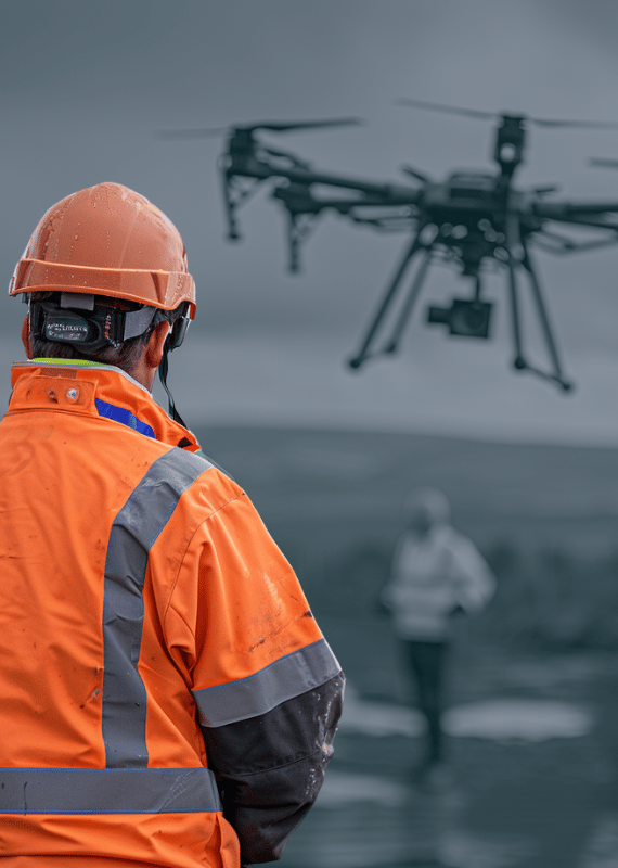
A drone forestry survey is a method of using unmanned aerial vehicles (UAVs), to collect data and capture images of forests from above. These drones can be equipped with cameras, LiDAR, and other sensors to capture detailed data and images of the forest canopy, understory, and ground cover.
This data can be used to assess the health and condition of the forest, monitor vegetation, detect pests and diseases, and conduct ecological surveys. Drone forestry surveys are a valuable tool for forestry management and can provide detailed and accurate data for making informed decisions about forest operations.
Request a Quote
Advanced Mapping and LiDAR for Detailed Forest Species Identification
Detailed Forest Species Identification
One of the many valuable features of our Forestry Surveying Service is species identification. Using the latest aerial imagery and LiDAR technology, we create detailed maps of your forested land that allow us to identify the species of trees growing on your property.
Our forestry surveying team has the expertise to provide accurate species identification data, which can be used in combination with GIS and other forestry analytics tools to develop detailed insights on forest health, growth monitoring, and environmental monitoring. By leveraging this data, we can support your forest management strategies with customised solutions that meet your unique needs.

Capture Aerial Forestry Data
Aerial Forestry
Survey Outputs

Commercial-Grade Lidar Forestry Drone Mapping
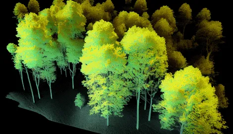
Commercial-grade LiDAR forestry drone mapping is a powerful tool for capturing highly accurate and precise 3D images and data of forested areas. It allows for efficient and safer data collection, even in hard-to-access forested areas.
The output from LiDAR includes DTMs, DSMs, and cross-sections of individual trees, providing detailed information about the forest floor, the height and density of the forest canopy, and tree structure and health. LiDAR technology can penetrate through vegetation, enabling detailed data collection on the ground surface and underlying terrain.
Photogrammetry Drone Forestry Mapping
Our photogrammetry drone forestry mapping produces 3D models that provide valuable information for forest management and conservation efforts.
The models can identify forest structure and health, canopy density, and ground elevation, providing insight to inform decision-making and support sustainable forest practices.
Our use of RTK technologies ensures that the output is highly accurate and reliable, allowing for informed and effective decision-making.
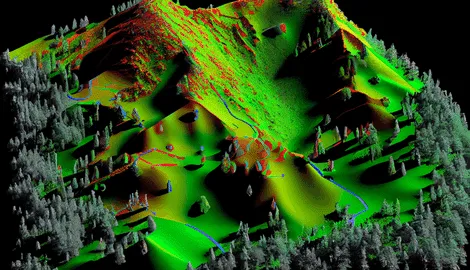
Geo-Referenced Orthomosaic Forestry Mapping
This service provides cost savings and precision 2D mapping through its rapid deployment and accurate measurements, making it an ideal solution for aerial forest surveys.
Our drone surveying service combines drone technology with ground control points to map the surface of a forested area, resulting in 8k ultra-high resolution digital maps. This level of detail is essential for forest management and conservation efforts. The precise mapping allows for the identification of forest structure, health, and areas that need attention, which informs decision-making and supports sustainable forest practices.
Maximising Accuracy with Drone Mapping
LiDAR Forest Survey UK
Our Lidar forestry surveys utilize advanced LiDAR technology to capture high-quality data and imagery. Using the Geocue Lidar and a 65Mp RGB camera on a Commercial Heavy Lift Drone, we can provide DTM or DSM with a high level of detail, achieving a typical accuracy of <3cm and ground sampling of <1cm.
This enables us to create highly accurate and detailed maps of your forestry assets, providing you with valuable insights to inform your management strategies.
By using the Geocue Lidar and a high-resolution camera on a Commercial Heavy Lift Drone, we’re able to provide superior data quality, enabling you to make more informed decisions about the management of your forestry assets.

Making Important Decisions with Confidence
Benefits of Using Drones in Forestry Mapping
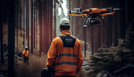
Overcome Challenging Woodland Terrain with Ease
Drones reduce the risk and cost associated with mapping in hazardous areas. With drones, surveyors can map forested areas from a safe distance, reducing the risk of injury or damage to equipment. With advanced GPS technologies, such as RTK and PPK GPS, drones can provide highly accurate data to inform decision-making and support sustainable forest practices.
Additionally, drones can operate in areas that may be difficult or dangerous for human surveyors to access, such as steep terrain or areas affected by natural disasters.
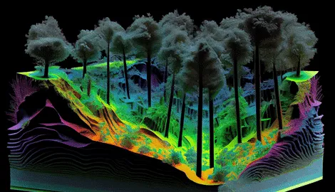
Obtain Ultra High-Resolution Aerial Forestry Data
When it comes to completing projects, we recognise that time is of the essence.
Therefore, we offer drone surveys that not only shorten the survey itself, but also the duration of the entire project.
Our drone forest survey streamline the entire process, from initial planning to final data processing and final product delivery, making them the ideal solution for time-sensitive projects.
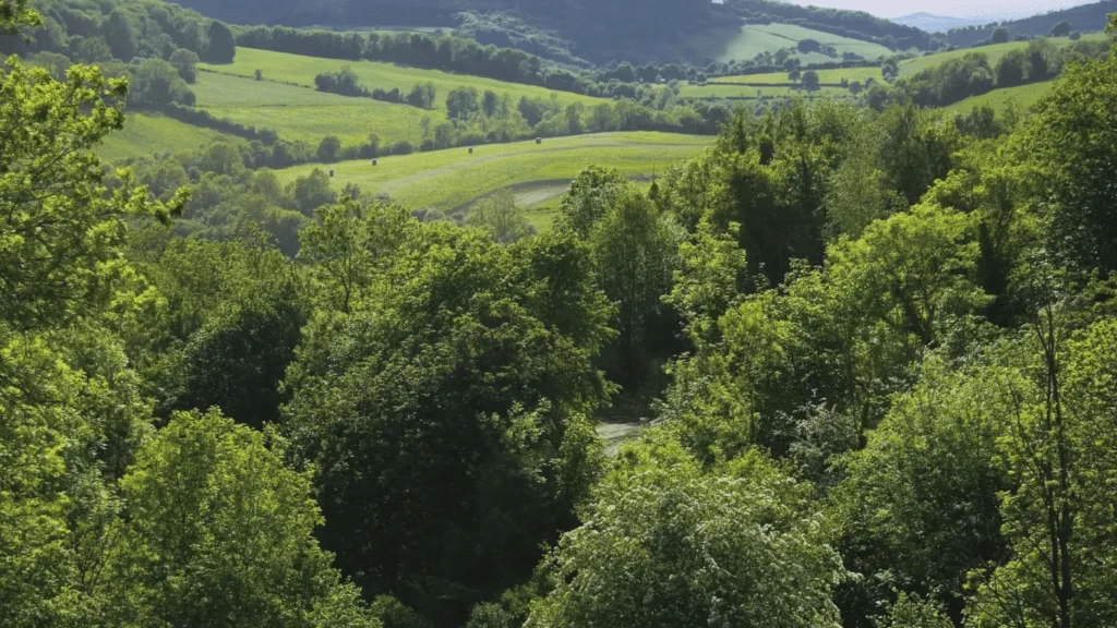
Save Time & Cost with Drone Forest Surveys
Our drone survey services provide a comprehensive, cost–effective, and efficient solution against traditional surveying methods. Our drones eliminate the need for heavy equipment and vehicles, can access difficult–to–reach areas, are equipped with advanced technology and high–resolution cameras, and streamline data processing and end–product delivery.
With our drone surveying services, you can save money, get detailed images and data, and have your end product delivered quickly, allowing you to make important decisions with confidence.

Highly Accurate Measurements
Timber Inventory Service
Our Timber Inventory service is an essential component of our forestry surveying services. Using LiDAR technology and advanced GIS, our team can accurately measure the volume and value of timber on your property. This information is crucial for effective forest management, helping you to make informed decisions about timber harvesting, regeneration, and more.
Our experienced team uses aerial imagery and point cloud data to create high-resolution orthomosaic images and topographical maps, allowing us to identify the locations of individual trees and calculate their heights with precision.
By leveraging our Timber Inventory service, you can streamline your forest management process and maximise the value of your timber resources.
Advanced Lidar Technology for Forest Management
Canopy Cover Survey Services
Our Canopy Cover Analysis service is a crucial part of our Forestry Surveying Services. Using advanced LiDAR technology, GIS, and aerial imagery, we can accurately measure the percentage of canopy cover on your forested land. Our team also employs digital elevation models (DEMs) and digital terrain models (DTMs) to create high-resolution orthomosaic images and topographical maps, allowing us to analyse the shape and health of the forest canopy.
The DSM provides an accurate representation of the canopy height, which allows us to determine the percentage of the forest floor that is covered by tree crowns and identify any areas where the canopy may be damaged or missing.
By leveraging our Canopy Cover Analysis service, you can gain comprehensive information about the productivity and environmental health of your forest and develop customised management strategies to maximise the productivity of your land.

Transforming Oil and Gas Industry with Unmanned Aerial Inspection
Slope Analysis for Erosion and Landslide Risk
Using advanced GIS, aerial imagery, and digital elevation models (DEMs), we can accurately measure the slope of your forested land. By analyzing the slope, we can determine the degree of steepness and gradient on the terrain, which can inform our forest management strategies. Our team also employs digital terrain models (DTMs) to support our Slope Analysis service, providing a detailed understanding of the topography and terrain of your land.
Slope Analysis can be used to identify areas at risk of landslides and soil erosion, allowing us to develop customised management strategies to mitigate these risks.
Additionally, Slope Analysis can support biomass and tree height estimation, canopy cover analysis, and growth monitoring, providing a more comprehensive understanding of your forest’s health and productivity.


Drone Technology for Accurate Biomass Estimation
Biomass Estimation and Carbon Assessment
We can accurately estimate the biomass of your forested land. This information is essential for accurate carbon assessment and to develop effective forest management strategies.
Our Biomass Estimation service can support tree counting and growth monitoring, providing a comprehensive understanding of your forest’s health and productivity.
By leveraging our Biomass Estimation service, you can gain accurate information about the carbon stored in your forest and develop customised management strategies to maximise the productivity of your land.

