UK Nationwide Support
Mobile Mapping Survey
Comprehensive mobile mapping survey services using the latest technology, including GPS, Mobile LiDAR, Photogrammetry, and Terrestrial laser scanning. We specialise in collecting geospatial data, 3D modeling, spatial analysis, and data acquisition.
Trusted By Leading UK Organisations
UK’s Leading Mobile Mapping Survey Service
Our mobile mapping survey services combine state-of-the-art technology, unmatched expertise, and a steadfast commitment to quality, delivering exceptional mapping solutions for our clients.
Our comprehensive mobile mapping survey services cater to a diverse range of projects, from urban planning and infrastructure management to environmental monitoring and asset inspection. We provide accurate, efficient, and reliable results that set us apart from the competition.
An unwavering dedication to client satisfaction has earned us a reputation as the UK’s foremost mobile mapping survey company, with a growing portfolio of satisfied clients and successful projects.
Discover the difference and experience the superior quality, accuracy, and efficiency of mobile mapping surveys that set us apart as the UK’s leading mapping survey company.
Trusted by Brands Demanding Unrivalled Accuracy
Contact Us for a Same-Day Quote!
Mobile Mapping for Infrastructure Development
What Is A Mobile Mapping Survey?
A mobile mapping survey is a cutting-edge method of collecting geospatial data using advanced technology mounted on a moving platform such as a vehicle, drone, or boat. It combines various sensors and techniques, including GPS, LiDAR, photogrammetry, and terrestrial laser scanning, to generate high-resolution, accurate representations of the environment.
Mobile mapping surveys are widely used in diverse applications such as urban planning, infrastructure management, environmental monitoring, and asset inspection. They offer the advantages of speed, efficiency, and flexibility compared to traditional surveying methods, enabling large-scale data collection in a shorter time and with minimal disruption to the surrounding area.
Request a Quote
Efficient Route Mapping Mobile Survey
Mobile Mapping For Urban Planning and Smart City Development
Drone Survey Services mobile mapping services provide valuable geospatial data for urban planners and smart city developers. With advanced technology and accurate data collection, we analyse land use, infrastructure needs, traffic patterns, and population density, assisting planners in making informed decisions about future growth and development.
Our mobile mapping services for urban planning and smart city development cover a wide range of areas, such as comprehensive city-wide mapping to identify infrastructure gaps and optimisation opportunities, traffic flow analysis to improve transportation systems and reduce congestion, population density mapping for better resource allocation and public service planning, and detailed 3D models of urban environments to facilitate the design and implementation of smart city technologies.

GIS and Mobile Mapping Survey
Aerial UAV
Subsurface Mapping UK

LiDAR Mobile Mapping
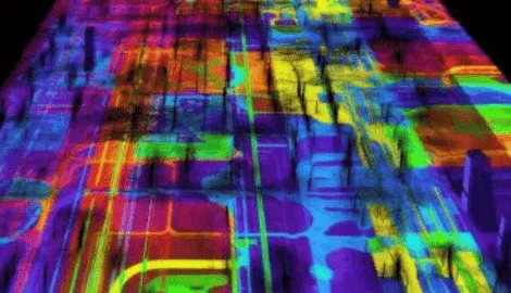
Mobile LiDAR technology is an advanced mapping system that allows for the efficient collection of high-resolution 3D data of various environments. The technology employs an integrated array of laser scanners that are mounted on a moving mobile vehicle. These laser scanners emit light pulses that bounce back from surrounding objects and are measured by sensors in the device, creating a detailed point cloud of the environment.
The mobile mapping systems utilizing this technology have the ability to capture millions of data points in just a few minutes, providing a comprehensive view of the surroundings. This data can be used for a variety of purposes, including infrastructure management, construction projects, asset management, and more.

Aerial Drone Mobile Mapping
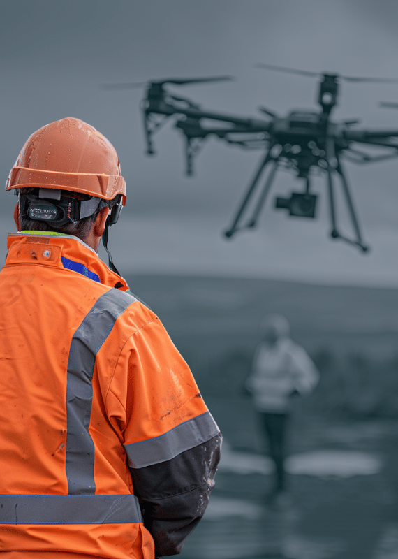
Drone Survey Services offers state-of-the-art aerial mobile mapping services using Unmanned Aerial Vehicles (UAVs) for efficient data collection in hard-to-reach or inaccessible areas. Our UAVs are equipped with high-resolution cameras and advanced GPS technology to capture accurate geospatial data.
Aerial mobile mapping is an ideal solution for large-scale mapping tasks, such as environmental monitoring, urban planning, and transportation and infrastructure projects. Image direct georeferencing simplifies the mapping control process, making it a cost-effective option for various mapping applications.
Handheld 3D Laser Scanning
Our integrated array of handheld 3D laser scanning solutions are designed to acquire survey data quickly and accurately for BIM survey model creation and measured building surveys. Our handheld Simultaneous Location And Mapping (SLAM) mobile laser scanning devices enables recording of building internals unobtrusively on-site in a fraction of the time conventional methods require.
This advanced technology captures data within RICS tolerances with absolute accuracy, allowing for the resulting ‘point clouds form’ to be processed into any form of required format, whether 3D BIM models or the form of 2D line drawings. Handheld 3D laser scanning is an efficient and versatile solution for various surveying and modeling needs.

Mobile Mapping Survey Process
Urban Planning and Smart City Development
Our mobile mapping services provide valuable geospatial data for urban planners and smart city developers. With advanced technology and accurate data collection, we analyse land use, infrastructure needs, traffic patterns, and population density, assisting planners in making informed decisions about future growth and development.
Our mobile mapping services for urban planning and smart city development cover a wide range of areas, such as comprehensive city-wide mapping to identify infrastructure gaps and optimisation opportunities, traffic flow analysis to improve transportation systems and reduce congestion, population density mapping for better resource allocation and public service planning, and detailed 3D models of urban environments to facilitate the design and implementation of smart city technologies.
Mobile Mapping Data Collection
Mobile Mapping Survey For Railway and Airport Surveys
Mobile mapping solutions for railway tracks and airport infrastructure, ensuring accurate planning, maintenance, and compliance with safety regulations. Our services deliver detailed geospatial data that can be used to enhance operational efficiency and passenger safety.
For railway and airport surveys, we offer railway track inspection and monitoring for maintenance planning and safety compliance, airport runway, taxiway, and apron mapping for efficient operations and maintenance, obstruction analysis and airspace mapping to ensure regulatory compliance and flight safety, and facility and asset management support for optimized airport operations.


Mobile Mapping Survey in Action
Integration with Mobile GPR for Sub-Surface Imaging
Our mobile mapping systems can be seamlessly integrated with Mobile Ground Penetrating Radar (GPR) for absolute accuracy and comprehensive above and below-ground data capture. Mobile GPR systems are positioned by GNSS and odometer as standard for such systems. For more challenging environments, such as city centers, tree-lined roads, and embankments, the more accurate trajectory of a mobile mapping system can augment this.
Simultaneously operating mobile GPR and mobile mapping systems offers a single-pass solution to capture highway infrastructure above and below ground. By combining these technologies, Leslie Drones provides a complete picture of the surveyed area, enabling better decision-making and project planning.
Mobile Mapping Survey Equipment
Mobile Mapping Survey Process
Planning and Preparation
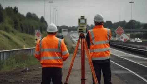
Before conducting the survey, our team defines the project objectives and scope, determining the required level of accuracy, and choose the appropriate mobile mapping technology (e.g., LiDAR, GPS, cameras).
The team will then need to plan the survey route, obtain any necessary permissions, and ensure all equipment is properly calibrated and functioning.
Increased Efficiency and Speed
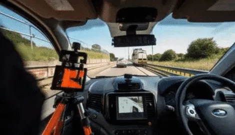
The mobile mapping survey is conducted using the chosen vehicle (e.g., car, drone, boat) equipped with the necessary sensors and cameras.
As the vehicle moves along the predefined route, the equipment collects geospatial data, such as 3D point clouds, geo-referenced images, and GPS coordinates.
This data is stored on-board and can be transmitted to a central server for further processing.

Save Costs With Drone GPR Surveys
Once the data is collected, it must be processed to generate accurate and useful geospatial information. This may involve tasks such as noise reduction, data alignment, geo-referencing, and feature extraction.
The processed data can then be analysed, visualised, and interpreted by specialists to meet the project’s objectives. The final deliverables may include maps, digital elevation models, or 3D models of the surveyed area.

Advanced Mobile Mapping Technologies
Coastal Mobile Mapping and Monitoring
Our mobile mapping survey services are well-suited for coastal mapping and monitoring applications. With accurate geospatial data collection and advanced analysis capabilities, we can help monitor coastal erosion, track changes in shoreline, and inform coastal management and planning decisions.
Our expertise in aerial mobile mapping and UAV technology enables us to cover large areas efficiently and accurately, providing valuable insights for environmental conservation and development projects.
High Precision Mobile Mapping Survey
Inland Waterway Mobile Mapping
innovative solutions for inland waterway mapping, utilizing our own mobile mapping system and technology to collect detailed information on riverbanks, channels, and other features.
This data is crucial for managing water resources, flood mitigation, infrastructure planning, and environmental monitoring. Our experienced team of surveyors ensures that the collected data is accurate, reliable, and tailored to your specific project requirements.


Mobile Mapping for Urban Planning
Increased Aerial Drone Mobile Mapping Accuracy
To keep accurate trajectory and ensure accuracy at the highest accuracy levels, we install ground control points (GCPs) at regular intervals within the survey area. These GCPs have known coordinates, which are used to keep accurate trajectory and enhance the accuracy of the point cloud during processing process.
Our mobile site and mobile mapping system and systems are equipped with GNSS technology capability, which provides accurate positioning data from multiple satellite systems, from such systems as GPS, GLONASS, and Galileo. This capability ensures the highest level of accuracy and reliability for your project.
