#1 Rated In The UK
Drone Stockpile Survey
UK’s leading drone stockpile survey service, we use hyper-high-resolution camera and LiDAR sensors allows us to capture intricate, quality data from your stockpiles. This data is integral to creating accurate volume calculations, supplying you with the detailed insights necessary for efficient inventory management, accurate financial forecasting, and effective supply chain operations.
Trusted By Leading UK Organisations
UK’s Leading Drone Stockpile Survey Company
Our team of specialised drone stockpile surveyors meticulously captures and processes data, providing you with in-depth insights into your stockpile volumes and inventory management. Our broad range of drone stockpile survey services includes volume calculations, material type identification, operational efficiency analysis, and environmental impact assessments.
Utilising this dataset, we create detailed maps and provide data to perform comprehensive stockpile evaluations. This helps you identify crucial areas of focus, evaluate stockpile stability, and monitor overall inventory levels.
Trusted by Brands Demanding Unrivalled Accuracy
Contact Us for a Same-Day Quote!
Elevate Your Inventory Management with Drone Surveys
What Is A Drone Stockpile Survey?
A drone stockpile survey refers to the use of drones or unmanned aerial vehicles (UAVs) to capture aerial data for measuring and monitoring stockpiles in industries such as mining, construction, and aggregates. This method is faster, more accurate, and safer than traditional ground-based surveying techniques.
Drones equipped with cameras or other sensors, such as LiDAR or photogrammetry, can capture high-resolution images and data points of stockpiles from various angles. The data collected by drones is then processed using specialised software to generate 3D maps and models, which can be used to calculate stockpile volumes with high accuracy.
This information is crucial for inventory management, financial forecasting, supply chain management, and accurate reconciliation.
Request a Quote
Soaring Above Traditional Methods with Drone Stockpile Surveys
Transforming Stockpile Management with Drone Technology
Embrace the future of stockpile management with Drone Survey Services, as we revolutionise the traditional process through cutting-edge drone technology.
Our drones, equipped with RTK and GCPs, provide rapid, cost-effective, and precise stockpile surveys, negating the safety risks inherent in manual methods. Drones capture a wealth of high-resolution data, offering a comprehensive 3D view for accurate stockpile volumes calculations and detailed stockpile analysis.
With the ability to conduct regular surveys, we ensure you have up-to-date inventory information at your fingertips, optimizing stockpile management and boosting operational efficiency.
Leave behind the limitations and inefficiencies of traditional methods, and step into the future with us.

The Future of Stockpile Management is Here
Benefits of Drone Stockpile Surveys

Unmatched Efficiency with Drone Stockpile Surveys
Leverage the efficiency of drone technology for accurate stockpile volume measurements. Our drones to measure stockpile volumes can quickly cover large areas, significantly reducing the time required for stockpile measurements.
By replacing manual data collection methods with our innovative approach, you receive accurate measurements, up-to-date stockpile data at just a few clicks, essential for precise inventory management and strategic decision-making.

Realise Cost-Effective Solutions and Enhanced Safety
Embrace our drone survey services for a cost-effective alternative to traditional methods, providing both accurate measurements of stockpile volumes and enhanced safety.
Not only do our services mitigate the hazards associated with traditional stockpile measurements, but they also prove to be cost-effective when compared to ground-based surveys. With a focus on safety, we ensure that accurate data is collected without exposing workers to potentially dangerous stockpile environments.

Precise Measurements and Regular Volume Updates
Our drone mapping services ensure you receive the most accurate stockpile volume calculations. We offer regular stockpile volume measurements for continuous monitoring of your stockpiles.
This point cloud data, collected via ground control points, provides you with a comprehensive stockpile analysis.
Regular updates lead to better stockpile inventory management, enabling you to know precisely how much material you have at any given moment.
Experience Unmatched Accuracy in Stockpile Measurement
Utilising Ground Control Points and For Enhanced Precision
GCPs are physical, large markers set out on the survey area whose coordinates are precisely known. These strategically placed markers serve as reference points that help geo-locate the aerial data captured by the drone.
When the drone captures images of the stockpile, it also includes images of these GCPs. Subsequently, in the data processing stage, the known coordinates of the GCPs are utilised to align and correct the captured data. This process ensures an accurate spatial representation of the stockpile, thereby significantly improving the precision of volume calculations.
This step is pivotal in reducing potential errors, guaranteeing the delivery of more accurate and reliable stockpile measurements.

Stockpile Surveys Redefined with Drone Technology
Dataset Deliverables of Drone Stockpile Surveys

Point Clouds
The culmination of drone survey technology and advanced data processing results in point clouds – an extensive set of data points in space that represent the surface of the stockpile.
These point clouds form a detailed, three-dimensional representation of your stockpile, providing a treasure trove of data for comprehensive analysis.
This level of detail and precision is unparalleled in traditional survey methods and can significantly enhance your understanding of the stockpile’s characteristics.

3D Maps and Models
Drone surveys transcend the limitations of 2D imagery. The high-resolution images captured by our drones are processed through specialised software, transforming them into dynamic 3D maps and models.
These models provide a spatially accurate representation of your stockpile, offering an in-depth insight into its structure and form.
This facilitates precise stockpile volume calculations and allows for a more robust analysis of your stockpile, leading to better decision-making.

Digital Terrain Models
Drone stockpile surveys also produce digital terrain models (DTMs), offering a continuous elevation representation of your stockpile.
These models are a powerful tool for further analysis and calculations, providing an accurate depiction of the stockpile’s surface topography.
From contour lines to slope analysis, the insights drawn from DTMs are instrumental in efficient stockpile management.

Empowering UK Industries with Accurate Drone Stockpile Surveys
RTK Accurate Drone Stockpile Volume Measurements
Moreover, we employ Real-Time Kinematic (RTK) technology to further enhance the precision of our drone surveys.
RTK is a GPS correction technology that reduces the errors caused by atmospheric delay and provides real-time corrections to the drone’s positional data.
Combined with GCPs, RTK technology enables us to provide highly precise stockpile data, critical for industries like mining, construction, and aggregates, where accurate stockpile measurements are essential for effective inventory management and accurate financial forecasting.
Making Stockpile Management Easier, Faster, and Safer
Drones For Stockpile Inventory Management
For the aggregates industry, drone surveys are indispensable in measuring stockpiles of materials like crushed stone, sand, and gravel. Our drone surveys provide highly accurate data, thus allowing for reliable stockpile volume calculations.
The ease of regular stockpile volume measurements ensures continuous inventory updates, leading to more precise supply chain management. With our drone technology, aggregate producers can effectively monitor stock levels, manage supply chains, and make informed business decisions.

Embrace the Future of Stockpile Surveys Today
Improving Inventory Management with Drone Surveillance
In logistics and delivery, our drones provide a significant advantage by monitoring supply chains and inspecting warehouses and distribution centres.
Drone Survey Services can help these facilities maintain a thorough stockpile inventory, ensuring efficient distribution of goods.
With detailed aerial views, our drones can identify stockpile locations, measure volumes, and capture irregularities or discrepancies, assisting in optimising space utilisation and improving stockpile management.


Get Unparalleled Insight into Your Inventory with Drone Surveys
Setting the Bar For Best Practices
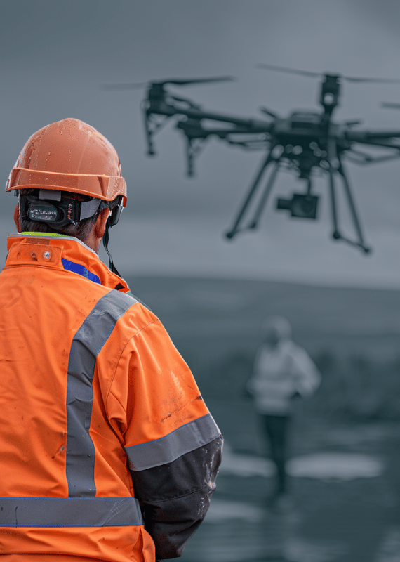
Adhering strictly to industry best practices, our approach to drone stockpile surveys combines meticulous flight planning, efficient data capture, and rigorous safety protocols with high-end post-processing and analysis techniques.
We ensure a precise flight path, check for optimal weather conditions, and carry out pre-flight drone checks. Our data capture techniques include capturing high-resolution images, maintaining consistent altitude and speed, and strategically placing Ground Control Points (GCPs).
We also adhere to local drone regulations, keep the drone within visual sight, and assign a visual observer for added safety. Post-flight, our team expertly processes the collected data to produce 3D maps, point clouds, and detailed reports.
Our adherence to these best practices results in accurate, safe, and efficient drone surveys, making us the trusted choice in industries like mining, construction, and aggregates.
